Examine the tangible relics, physical tokens, and revolutionary machines that shaped civilizational growth.
🎥 VIDEO HUB & SHORTS
Watch visual summaries, site intros, and mini-documentaries chronicling 300,000 years of world history.
📊 HISTORICAL INFOGRAPHICS ARCHIVE
Museum-grade visual graphics, civilizational timelines, and architectural breakdowns curated for educators and history lovers.
THE HISTORIA CIRCLE
Join the collective discussion, study logs, and contributions of fellow historians mapping humanity's path.
Historia Forum Discussions
Start a Discussion Thread
THEMATIC PATHWAYS
Trace a single thread — disease, trade, energy, migration — across all eras and civilizations.
History is not just a sequence of events — it is a network of patterns. These thematic pathways allow you to follow a single concept across thousands of years: how agriculture spread, how warfare evolved, how trade routes shaped civilizations. Each pathway collects the most relevant chronicles across all eras.
🧩
How is this different from the sidebar Topics?
While the sidebar Topics (like Science & Tech or Empires) filter articles within your selected historical Era, Thematic Pathways cut horizontally across all eras (from Prehistoric to the Future). Use Themes to trace a single concept's evolutionary line across 300,000 years.
CIVILIZATION HUBS
Comprehensive profiles of the world's greatest civilizations and empires — from ancient cradles to global super-states.
Human Historia provides an academically rich exploration of the world's most influential civilizations. From the monumental achievements of ancient Egypt, Han China, and the Roman Empire, to the sophisticated societies of the Maya, the Islamic Caliphates, and West African empires, these hubs offer deep insights into the cultural, political, and technological legacies that continue to shape our global story.
EVOLUTION OF HUMAN SKILLS
Trace the compounding technologies, practical capabilities, and cognitive milestones of the human species.
Human progress is a story of compounding skills. Every breakthrough, from the spark of prehistoric fire to modern silicon transistors, builds directly on previous generations of ingenuity. Hover over a skill node to trace its historical prerequisites, and click it to explore its development timeline, species-wide impact, and related chronicles.
Prehistoric Ancient Medieval Modern Future
🧠
Select any skill node in the tree to explore its evolutionary path, development timeline, and historical impact.
ACADEMIC PASSPORT
Track your intellectual journey, quiz outcomes, and historical badges of honor.
HISTORIA PASSPORT⏳
👤Scribe Novice
Scholar NameHistoria Explorer
Rank RatingSumerian Record Scribe
Chronicles Read0 / 48
Study Guide Pins0 Guides
Security AccessLevel 1 (Novice)
Earned Badges of Honor
🔥
Fire Keeper
Unlock 3 prehistoric chronicles.
🏛️
Codex Keeper
Unlock 3 ancient chronicles.
🏰
Guild Master
Unlock 3 medieval chronicles.
⚙️
Steam Engineer
Unlock 3 modern chronicles.
🚀
Singularity Sage
Unlock 3 future chronicles.
👑
Grand Scholar
Score 5/5 on the Lab Quiz.
Recent Lab Activities
No recent activities recorded. Take a quiz or bookmark articles!
Curated Exhibition
Human Historia
An immersive graphical anthology tracing the paths of civilizations, breakthroughs, and conflicts that forged the modern consciousness.
Written by Historia TransportHistorical Era: MEDIEVAL
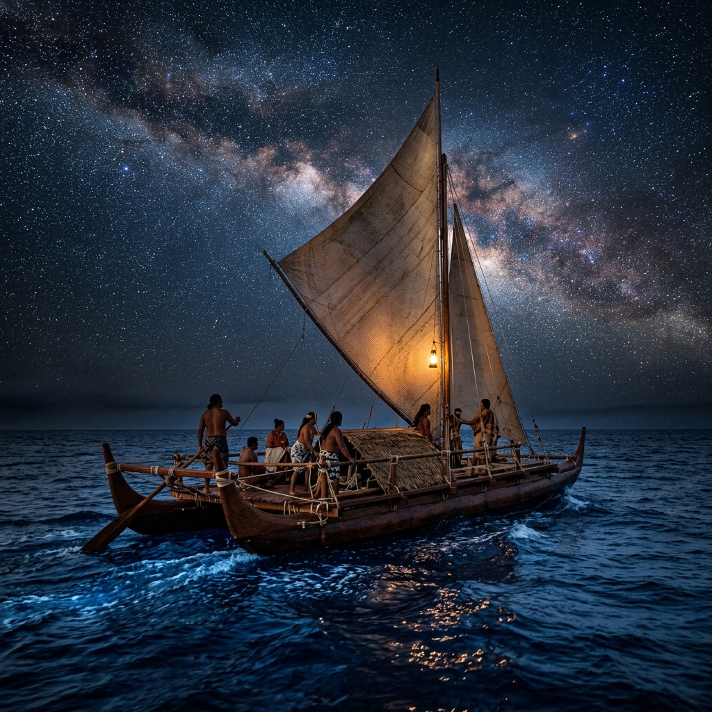
🎨 Historical Illustration (AI)
* Note: Cover image is an AI-generated historical illustration.
🧠Key Chronicle Takeaway (Atomic Summary)
The greatest feat of pre-modern navigation — crossing 10 million square kilometers of open Pacific using star paths, wave patterns, and the color of water. How living tradition nearly died under colonialism, and how it came back.
Sometime around 1,000 CE, a group of people set out from somewhere in eastern Polynesia — possibly the Marquesas Islands, possibly the Society Islands, the debate is unresolved — and sailed their double-hulled canoes into open ocean. They had no compass. They had no sextant. They had no chart marked with latitudes and longitudes, no celestial globe, no mechanical clock. They were sailing into the largest expanse of open water on earth — the Pacific Ocean, which covers a third of the planet's surface and whose islands, scattered across ten million square kilometers, occupy in total less area than the state of Louisiana. By the time they stopped, perhaps a few weeks later, they had reached New Zealand, the last major landmass on earth to be permanently settled by humans, two large islands lying in the temperate south Pacific at roughly 40 degrees latitude. This voyage was not lucky. It was not accidental. It was the culmination of a navigational tradition developed over thousands of years of intentional ocean exploration — a tradition so sophisticated that its practitioners could read the ocean's surface the way a scholar reads a manuscript: with trained eyes that extracted precise information from what an untrained observer would see as undifferentiated water.
Historical Context
Polynesia — the vast Pacific triangle bounded by Hawaii in the north, New Zealand in the south, and Easter Island (Rapa Nui) in the east — was settled in a series of voyages that represent the most extraordinary geographic expansion of any pre-modern human population. The ancestors of Polynesian peoples are now traced, through linguistics, archaeology, and genetics, to the Lapita cultural complex: a group of skilled seafarers who appear in the archaeological record of the Bismarck Archipelago (near modern Papua New Guinea) around 1500 BCE, marked by a distinctive style of dentate-stamped pottery. From this origin zone, the Lapita and their descendants moved steadily eastward, reaching Tonga and Samoa by around 900 BCE, eastern Polynesia (the Marquesas, Society Islands, and Cook Islands) by approximately 300 CE, and then — in what the archaeologist Patrick Kirch has called the "second phase" of Polynesian expansion — completing the settlement of Hawaii, New Zealand, and Easter Island in the period roughly 1000–1300 CE.
Each of these voyages required sailing against the prevailing trade winds, which blow from east to west across the tropical Pacific. This meant either waiting for seasonal westerly reversals or deliberately tacking into the wind — a feat that required deep knowledge of seasonal patterns and sophisticated boat technology. The double-hulled voyaging canoe (waka hourua in Māori, wa'a kaulua in Hawaiian) was among the most seaworthy vessels in the pre-modern world: its two parallel hulls connected by a rigid deck platform could carry several dozen people, animals, plants, and supplies; its crab-claw sail could be positioned to sail efficiently on multiple points of the wind; and its shallow draft made it possible to land on beaches and barrier reefs that would destroy a deep-keel vessel.
The precision of Polynesian navigation has been confirmed repeatedly since the late 20th century through experimental voyages, most spectacularly by the Hawaiian double canoe Hokule'a, which since 1976 has completed voyages totaling over 150,000 nautical miles using traditional navigation methods alone — including a circumnavigation of the globe completed in 2017.
Why It Happened: Reading the Ocean
What did a Polynesian wayfinder actually know that made open-ocean navigation across thousands of miles of featureless water possible? The answer is a layered system of environmental reading that used every sensory input available and required years of apprenticeship to master.
The most important tool was the star compass. Polynesian wayfinders memorized the rising and setting points of over 150 stars and navigated by keeping their vessel aligned with the star that rose or set at the bearing they needed. Because stars rise and set at fixed azimuths (relative to true north) throughout the night, a navigator who knew where a particular star rose and knew which island lay in that direction could use that star as a course-setter — and as one star rose too high to be useful, another would take its position near the horizon. The star compass was not a physical object; it was a mental map, a memorized grid of bearings organized by star name, maintained in the navigator's mind and continuously updated as the night progressed.
But stars are useless in daylight, on cloudy nights, or in the overcast conditions that are common in the tropical Pacific. For these situations, Polynesian navigators relied on the ocean swell. The deep Pacific carries long-period ocean swells — generated by distant weather systems thousands of kilometers away — that maintain consistent direction for days or weeks regardless of local wind and cloud conditions. A skilled navigator could feel the swell's direction through the motion of the hull beneath his body, even while lying down or attending to other tasks, and could identify which of three or four dominant Pacific swells was currently moving under the canoe, then use this information to determine or confirm direction. The navigator Mau Piailug of Satawal, Micronesia — who was crucial to the revival of traditional navigation in the late 20th century — described lying across the hull of his canoe to feel the ocean's movements with his entire body, effectively turning himself into a human gyroscope.
Additional environmental cues included:
Bird species and behavior — certain bird species (the golden plover, the noddy tern) follow predictable routes between islands; their presence and flight direction could indicate proximity to land up to 50 km away
Cloud formations — islands generate characteristic clouds from their topography; cumulus clouds that remain stationary while surrounding clouds move with the wind indicate land below
Water color and temperature — shallow lagoon water appears pale green even from a distance; water temperature changes detectably near islands due to freshwater outflow and current deflection
Phosphorescent wake — the pattern of bioluminescent organisms disturbed by the canoe's passage changes in characteristic ways near islands
Swell refraction and reflection — islands disturb the deep Pacific swell, creating interference patterns that extend up to 50–100 km from land and that a skilled wayfinder could read from the hull's motion
The Hokule'a, a double-hulled Hawaiian voyaging canoe built in 1975 by the Polynesian Voyaging Society, has completed over 150,000 nautical miles of traditional navigation since its launch, including a circumnavigation of the globe in 2017. It has done more to validate and revive Polynesian wayfinding traditions than any single scholarly study.
Mau Piailug and the Revival of a Lost Art
By the mid-20th century, traditional Polynesian navigation was close to extinction as a practiced art. Colonial disruption, the availability of Western maritime technology, and the suppression of indigenous practices had reduced the number of living master navigators — called pwo in the Micronesian tradition that maintained the knowledge most completely — to a handful of elderly men on remote islands. The most important of these was Pius Mau Piailug of Satawal atoll in the Caroline Islands, who had been trained as a pwo navigator and who carried in his memory a complete navigational system for the central Pacific.
In 1976, when the newly formed Polynesian Voyaging Society launched the Hokule'a and proposed to sail it from Hawaii to Tahiti using traditional navigation, they faced a significant problem: there were no Hawaiian navigators who retained the traditional knowledge. The anthropologist Ben Finney, who organized the project, approached Mau Piailug, who agreed — despite speaking virtually no English and having no prior contact with Hawaiian culture — to navigate the canoe on this voyage. Mau navigated Hokule'a from Hawaii to Tahiti in 34 days, without instruments, arriving within five miles of his intended landfall. The voyage electrified Hawaii and the broader Pacific community, beginning a cultural revival that is now called the "Polynesian wayfinding renaissance."
Mau subsequently trained the Hawaiian navigator Nainoa Thompson, who became the first person since the 18th century to navigate traditional Polynesian voyages across the open Pacific. Thompson, the Polynesian Voyaging Society, and their collaborators have since completed voyages to every major Pacific island group, trained dozens of new navigators, and built new voyaging canoes in Hawaii, New Zealand, the Cook Islands, and Rapa Nui. The revival is not merely a cultural curiosity; it is a functioning restoration of a sophisticated knowledge system that had come within a generation of being permanently lost.
The Kon-Tiki Problem
In 1947, the Norwegian explorer Thor Heyerdahl sailed a balsa wood raft named Kon-Tiki from Peru to the Tuamotu Islands in French Polynesia, covering roughly 6,900 km in 101 days. His purpose was to prove that South Americans could have settled Polynesia — a theory he developed from cultural similarities he believed he saw between Andean and Polynesian civilizations. The voyage captured global attention, won Heyerdahl an Academy Award for the documentary film, and sold millions of books. It was also, according to linguists and geneticists, almost certainly wrong about its central claim. The linguistic evidence — analyzed by scholars including Andrew Pawley — is overwhelming that Polynesian languages derive from Austronesian ancestors in Southeast Asia and Taiwan, not from South America. Genetic studies published in 2021 in Nature confirmed Austronesian origins while finding only trace South American DNA in a few eastern Polynesian populations, and suggesting contact with South America happened late and from west to east (i.e., Polynesians reached South America, not the reverse). Heyerdahl proved you can drift from South America to Polynesia; he did not prove anyone actually did so intentionally.
Social & Human Effects: Knowledge as Inheritance
The knowledge required for long-distance Polynesian navigation was not distributed equally across the population. It was held by specialists — navigators who trained for years under masters in traditions that were partly secret, partly sacred, and entirely oral. In Micronesia, the pwo initiation ceremony marked a navigator's formal entry into full competence and was accompanied by ritual obligations and social recognition. The navigator's knowledge was property — heritable, transferable only through proper training relationships, and in some island societies a source of political authority comparable to hereditary chieftainship.
This social structure meant that navigational knowledge was both more concentrated and more vulnerable than a purely distributed oral tradition would be. When colonial disruption broke the chain of master-to-apprentice transmission — when mission schools replaced traditional education, when young men found employment on Western ships rather than apprenticing to local navigators — the knowledge concentrated in a few individuals could vanish within a single generation. In Hawaii, where traditional navigation had been interrupted since at least the late 18th century, it had effectively vanished by 1900. In Satawal, where Mau Piailug's family had maintained the tradition more completely, the final thread survived into the late 20th century only barely.
The revival of Polynesian navigation has had social effects that go well beyond the technical recovery of a wayfinding system. In Hawaii, the Hokule'a voyages triggered a broader cultural renaissance — a renewed interest in Hawaiian language, traditional hula, traditional farming, and indigenous rights — that has been described by political scientists as one of the most successful indigenous cultural revival movements in the world. In New Zealand, the Aotearoa voyaging canoe traditions have become a vehicle for Māori identity assertion in ways that intersect with land rights, language revitalization, and the ongoing renegotiation of the Treaty of Waitangi. The navigation revival is, in this sense, political as much as cultural.
Economic Consequences: The Exchange Networks of the Pacific
The voyaging canoe was not merely an explorer's tool — it was, for Pacific societies, the functional equivalent of a road and a merchant ship combined. The inter-island exchange networks of the Pacific, which moved basalt adze stone, shell valuables, tapa cloth, feathers, and food across hundreds and in some cases thousands of kilometers, depended entirely on the continued capability of voyaging canoes. In the Carolinian and Micronesian islands, the sawei exchange network — documented by anthropologists including William Alkire — connected islands from the Marianas to the Satawalese atolls in a web of reciprocal obligation that provided insurance against local crop failures: an island that lost its taro crop to typhoon could call on its sawei partners for food.
The Lapita exchange network that preceded Polynesian settlement was similarly extensive: obsidian from the Admiralty Islands has been found in archaeological sites more than 2,000 kilometers distant, and Lapita pottery styles maintained extraordinary consistency across this geographic range, indicating frequent enough contact to keep material culture synchronized. The economic historian Marshall Sahlins, writing in the 1970s, described Pacific exchange economies as "generalized reciprocity" systems — networks in which goods moved in response to social obligation rather than market pricing, and in which the return of a gift was expected but not immediately demanded. This description has been refined by subsequent anthropologists, but the fundamental insight remains: Pacific ocean voyaging created and maintained economic networks across distances that no land-based civilization of comparable technological level could match.
⚖️
Historian Debate: Did Polynesians Reach South America?
Contact Evidence View
A significant body of evidence suggests that Polynesians did reach South America — and returned with the sweet potato (kumara), a crop whose presence across eastern Polynesia before European contact can only be explained by human transport from its South American origin. Linguistic analysis shows that the Polynesian word for sweet potato (kuumala in Hawaiian) is cognate with Quechua terms for the same plant. A 2020 genetic study of ancient and modern sweet potato samples by Muoz-Rodrguez and colleagues confirmed South American origin. The 2021 Nature study by Ioannidis and colleagues found traces of South American ancestry in populations from five eastern Polynesian islands, consistent with pre-European contact between Polynesians and an Amerindian population.
Skeptical View
While most scholars now accept that some form of contact occurred, the direction, frequency, and cultural significance of that contact remains disputed. The South American genetic signal in eastern Polynesian populations is small and appears to date to a single contact event around 1200 CE — not a sustained exchange relationship. Some researchers argue that the sweet potato could have arrived in Polynesia through natural dispersal (floating on ocean currents) rather than human transport, though this explanation is regarded skeptically by most botanists. What is nearly universally rejected is Heyerdahl's original claim that South Americans settled Polynesia; the evidence for Austronesian origins is overwhelming.
Scholars such as Patrick Kirch, David Burley, and the team behind the 2021 Nature genetic study (Ioannidis et al.) have shaped this debate through works including Kirch's On the Road of the Winds (2000) and the paper "Native American Gene Flow into Polynesia Predating Easter Island Settlement" (2020, Nature).
"The navigator does not use instruments. He uses his mind. He sees the island in his mind and he sails to it. The star compass is in his head, the swell patterns are in his body, the flight of the birds is in his eyes. He carries the ocean inside himself."
— Mau Piailug, Micronesian master navigator from Satawal Atoll, as recorded by anthropologist David Lewis in We, the Navigators: The Ancient Art of Landfinding in the Pacific (1972). Piailug navigated the Hokule'a from Hawaii to Tahiti without instruments in 1976.
Long-Term Legacy
The Polynesian navigational tradition is, by any reasonable measure, one of the greatest sustained achievements of practical human intelligence in the pre-modern world. Across roughly two thousand years of active expansion, Polynesian and proto-Polynesian wayfinders explored and settled an ocean larger than all the world's landmasses combined — locating islands that cover, in some cases, less than a square kilometer in a sea that covers ten million — using only the knowledge carried in trained human minds and the sensory information provided by wind, wave, star, and bird. When we call the Pacific "empty," we reveal how thoroughly we have projected a European mariner's anxiety onto an environment that Polynesian navigators read as a map.
The Polynesian Voyaging Society's Hokule'a completed a Malama Honua ("caring for island Earth") global circumnavigation in 2017, visiting over 150 ports in 26 countries and carrying a message about environmental stewardship and cultural preservation. That a 47-meter double-hulled canoe built on pre-modern design principles could complete a circumnavigation of the globe using star paths and swell patterns alone is perhaps the clearest demonstration available of what the navigational tradition actually meant: not a primitive solution to a problem that better technology eventually solved, but a complete and coherent knowledge system that read the natural world with a precision that modern GPS technology can replicate but not supersede — because the ocean still holds information, and we have largely forgotten how to read it.
David Lewis — We, the Navigators: The Ancient Art of Landfinding in the Pacific (1972). The foundational modern study of traditional Pacific navigation, based on Lewis's own voyages with surviving master navigators.
Patrick Kirch — On the Road of the Winds: An Archaeological History of the Pacific Islands Before European Contact (2000). The definitive archaeological synthesis of Pacific prehistory by the field's leading practitioner.
Ben Finney — Voyage of Rediscovery: A Cultural Odyssey Through Polynesia (1994). A personal account of the Hokule'a voyages and the Polynesian cultural renaissance they sparked.
Sam Low — Hawaiki Rising: Hokule'a, Nainoa Thompson, and the Hawaiian Renaissance (2013). A richly detailed narrative of the Polynesian Voyaging Society and the role of navigation revival in Hawaiian cultural politics.
Thor Heyerdahl — Kon-Tiki (1948). Essential reading as a historical artifact of mid-20th-century assumptions about Pacific prehistory, even though its central thesis has been comprehensively refuted.
📖 Scholar Mode Active — Click to exit focused reading
History Lab 🧪
Run simulated matches between civilizations and convert ancient currencies.
🕵️ Who Am I? (The Historical Guess Game)
A secret historical figure has been selected. Ask yes/no questions to narrow down the pool of candidates. Click any active card to make your accusation!
Secret Identity
❓ Who Am I?
Ask questions using the board below to narrow down my identity.
Ask a Question:
Question LogQuestions: 0 / 7
No questions asked yet.
Candidate Board:
🗺️ Timeline Scramble
Five historical events appear out of order. Click them in the correct chronological sequence — from oldest to most recent. How well do you know your history?
🏺 Relic or Fake?
Is this a real historical artifact or a convincing fabrication? Judge each one based on its description and era — then see the truth revealed!
Artifact 1 / 10Score: 0
Empire Matchup Simulator
Empire ATerritory Size (Peak, M km²)Empire B
00
Empire APopulation (Peak, Millions)Empire B
00
Empire AMilitary Power (Army Size)Empire B
00
Tactical Battle Analysis
Select empires and click simulate to run evaluations.
Historical Purchasing Power Converter
See what ancient coins are worth in modern terms and check their historical purchasing power.
Modern Value Equivalent
$0.00 USD
Historical Purchasing Power:
Select currency to view purchasing capability.
Historical Identity Generator
Forge an authentic historical identity from ancient civilisations, complete with linguistic meaning and biography.
Neutral
Gaius Julius
Meaning:Descendant of Jupiter
Historical Background:
A Roman citizen and clerk who worked in the forum under Roman republic rule.
Chrono-Cultural Fusion Simulator
Fuse the culture, technology, and governance of two legendary civilizations to synthesize a unique hybrid society.
Cohesion & Coexistence Rate
85%
🏛️ Hybrid Architecture
⚙️ Synthesized Asset
📜 Synthetic Governance
Historical Tactics & Trivia Quiz
Test your historical knowledge and battle tactics to claim your administrative rank.
8 Questions • Multi-Era
You will be presented with random scenarios and trivia spanning ancient Egypt, classical Rome, Islamic Golden Age, and the modern industrial era. Complete the evaluation to see your historical title!
Question 1 of 8Score: 0
What was the Code of Hammurabi written on?
Correct!
Evaluation Complete!
6 / 8
Correct
Rank Attained
Imperial Legionary
Your knowledge of classical strategy and administrative structures is respectable.
🎲 Counterfactual "What If?" Scenario Simulator
Explore alternative historical trajectories by tweaking key civilizational pivot points.
Simulated Shift
Selected Era
Prehistoric Era
Millions of years ago to ~3000 BCE
The dawn of humanity. From the evolutionary split of early hominids to the mastery of stone tools, fire, and the birth of language.
Landmark Milestones
Welcome to Historia
Enter your Scholar Name to synchronize your chronicles and save your journey.